
Fire Adapted 50: Phase 1a (Sly Park) is part of a series of wildfire fuels reduction projects to be completed through Fire Adapted 50, an innovative all-lands approach to increasing fire resiliency and fire adapted communities along the Wildland-Urban Interface (WUI) of the U.S. Highway 50 corridor. Phase 1a is located immediately adjacent to Phase 1 within Sly Park. The area is close to the King Fire Burn area which consumed 97,717 acres in the fall of 2014. The event threatened 12,000 residences, destroyed 12 residences and 68 other structures and damaged critical infrastructure including facilities, roads, bridges and electrical transmission and distribution lines (USFS Record of Decision (ROD) King Fire 9/15). The impact of the King Fire and prolonged drought have increased awareness about the susceptibility of communities and watershed resources to such catastrophic wildfires. As a result, CAL FIRE, in collaboration with federal, state and local agencies and private landowners have put forth a response in the form of a long term cohesive strategy to establish a more fire resilient WUI condition with a focus on the Highway 50 Corridor. Work on Phase 1a is currently on-going. A total of ~831 acres of land will be treated using mastication and hand thinning methods.
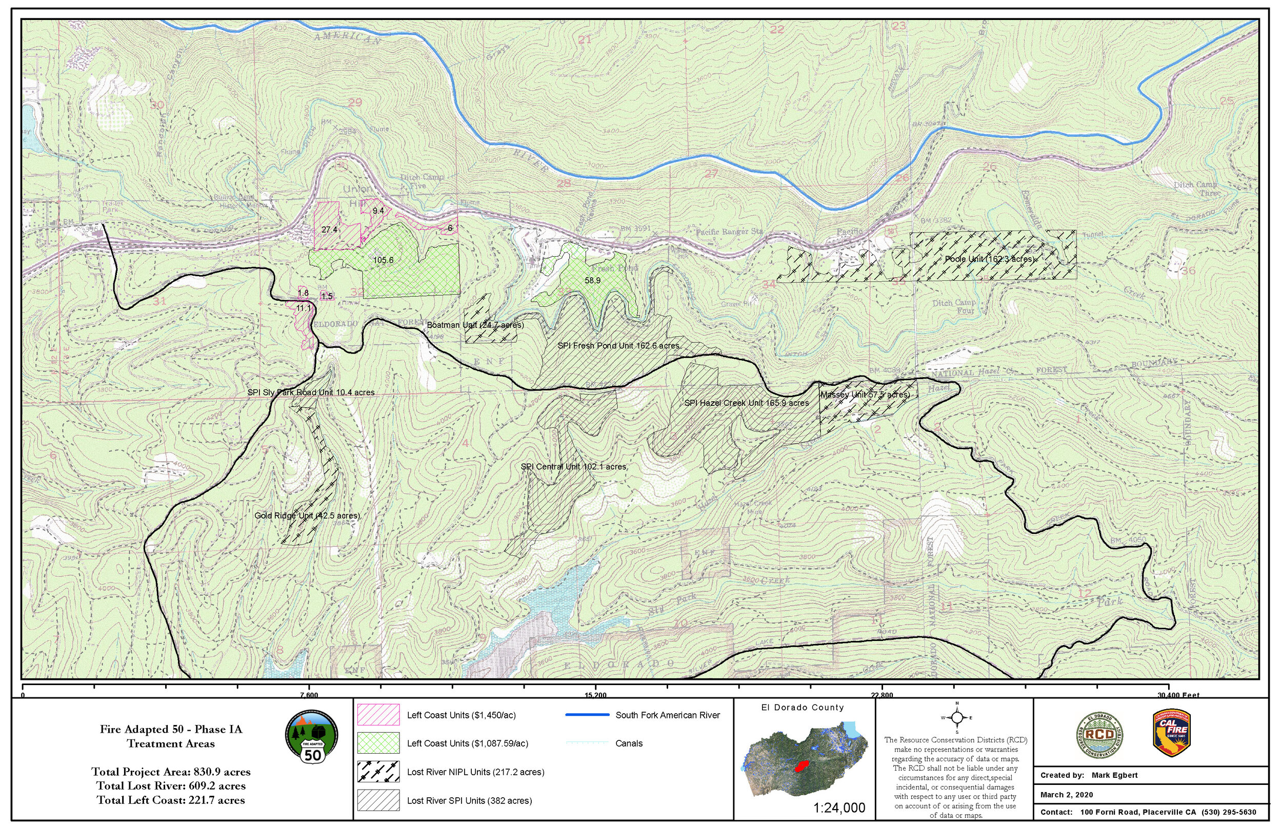
Treatment Map

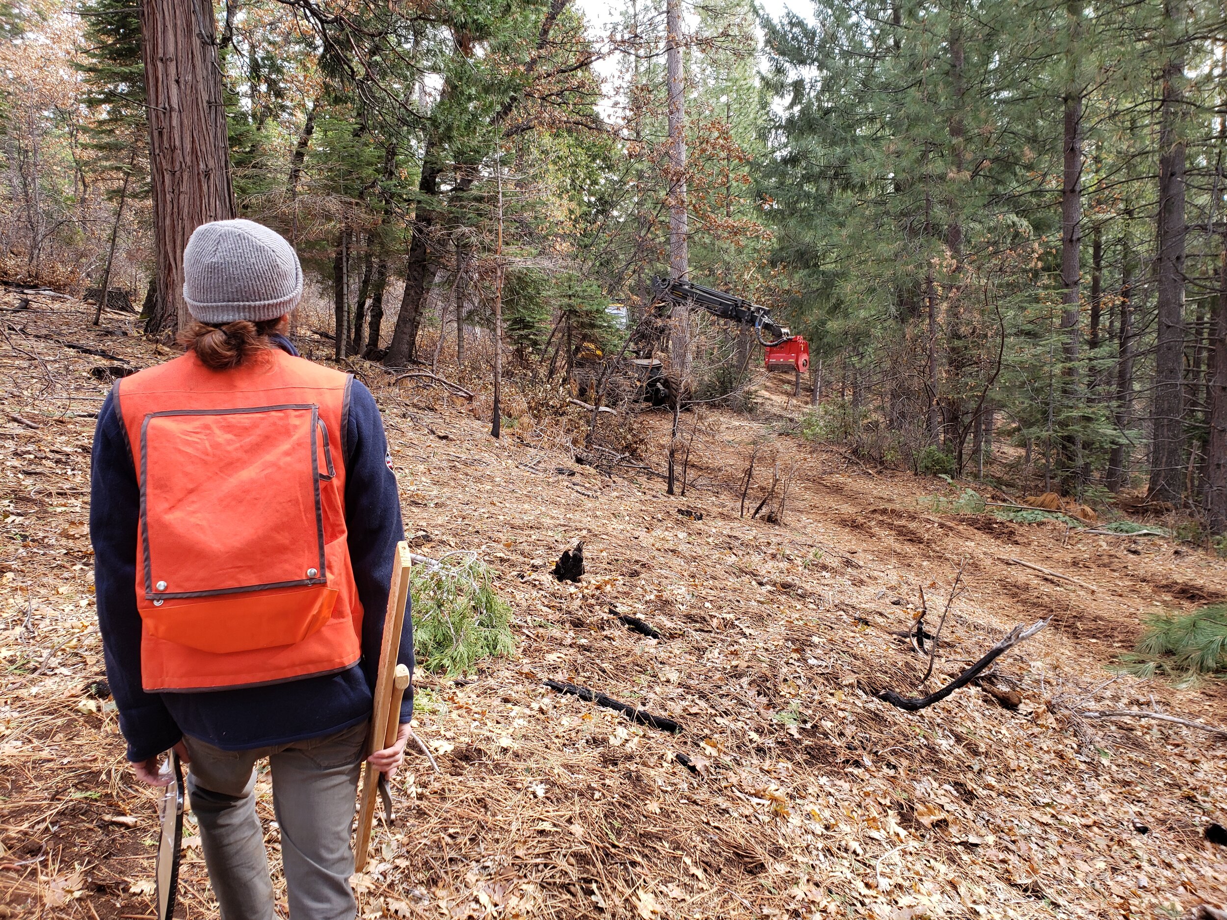
Before Treatment
Example of pre-treatment conditions at photo point #4, May 2020

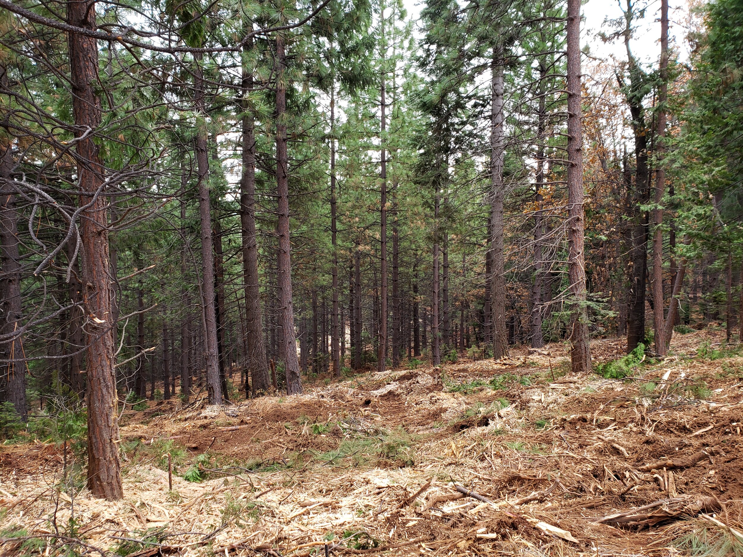
After Treatment
Example of post-treatment conditions at photo point #4, September 2020
PROJECT LOCATION
The Project is located near Pollock Pines in central El Dorado County, California at an elevation of approximately 3600 feet MSL within (Figure 1):
Township 10 North, Range 13 East, Sections 2, 3, 4, 5, 6, 7, 8, 9, 10, 11, 15, 16, 17, 18, 19, 20 Mount Diablo Base & Meridian within the USGS 7.5-minute Sly Park Quadrangle;
Township 11 North, Range 13 East, Sections 31, 32, 33 Mount Diablo Base & Meridian within the USGS 7.5-minute Pollock Pines Quadrangle;
Township 10 North, Range 14 East, Sections 1, 12 Mount Diablo Base & Meridian within the USGS 7.5-minute Stump Spring Quadrangle.
It is approximately 60 miles east of Sacramento and approximately 50 miles west of South Lake Tahoe, and can be accessed from U.S. Highway 50 via Sly Park Road. Land uses surrounding the site include single-family residential development and commercial properties, industrial forest land, recreation areas, and public lands.
PROJECT OBJECTIVES
The overall objectives of this project are to return forests and wildlands to a more natural, fire resilient condition and to ensure that the community’s risk has been reduced. This fuel modification treatment strategy has identified Sly Park as a WUI defense zone where the focus is on protecting life and property. The strategic fuel management project should help to contain wildfires and facilitate long-term stewardship through practices such as continued mechanical and hand treatment and prescribed fire.
Specific objectives include:
Support an all-lands approach to create fire resilient and fire-adapted communities along the Highway 50 corridor,
Use existing fuel breaks and forest treatments to create large, more fire resilient fuel breaks,
Protect communities, infrastructure, and forest resources within the WUI,
Conduct vegetation prescriptions to reduce fire hazard, improve tree growth, and increase forest resiliency;
Conduct vegetation prescriptions to reduce the rate of spread, duration and intensity, and fuel ignition of crowns;
Retain or enhance ecosystem processes compatible with the fuel hazard reduction prescription;
Assess carbon sequestration and greenhouse gas reduction benefits by reducing the likelihood of wildfire emissions, improving the health and growth rates of trees and exploring various biomass utilization opportunities;
Identify measures that may be required to protect watershed values and water quality in watersheds that are important sources of domestic water supply;
Utilize the project as an educational opportunity to increase community awareness associated with living in a WUI;
Retain post-treatment landscape condition under long-term stewardship agreements.
Questions about this project?